its4land
About
Project description
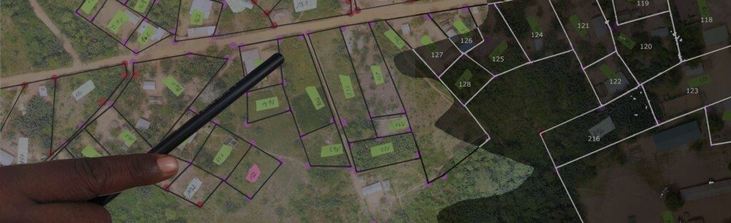
Smart Sketching


Project Team
At a glance:
Funding Period 1:
Publications
2021
Innovative geospatial solutions for land tenure mapping
Mila Koeva, Claudia Stöcker, Sophia Crommelinck, M Chipofya, Kaspar Kundert, A Schwering, Jan Sahib, T Zein, Christian Timm, MI Humayun, Joep Crompvoets, Evrim Tan, Cesar Casiano, Placide Nkerabigwi
Rwanda Journal of Engineering, Science, Technology and Environment
2020
Local Domain Models for Land Tenure Documentation and their Interpretation into the LADM
Chipofya, Malumbo; Karamesoutib, Mina ; Schultz, Carl, Schwering, Angela
Land Use Policy
2018
THE MAASAI OF SOUTHERN KENYA DOMAIN MODEL OF LAND USE
M. Karamesouti1, C. Schultz2, M. Chipofya1, S. Jan1, C. E. Murcia Galeano1, A. Schwering1, and C. Timm3
The Maasai of southern Kenya domain model of land use
Karamesouti M., Schultz C., Chipofya M., Jan S., Eduardo Murcia Galeano C., Schwering A., Timm C.
ISPRS Journal of Photogrammetry and Remote Sensing
2017
Towards Smart Sketch Maps for Community-driven Land Tenure Recording Activities
Chipofya M, Jan S, Schultz C, Schwering A