Large-scale spatial abilities are a key part of human cognition: They support navigation and help us integrate spatial information as we move through environments. Although essential for everyday life and learning, they are still rarely included in standardized assessment research because they are difficult to measure consistently.
At the CogSci 2026 tutorial, we offer hands-on training in assessing large-scale spatial abilities in real and virtual environments. Participants will explore cutting-edge methods for studying navigation and wayfinding using immersive technologies and standardized task design. Join us in Rio to gain practical experience with VR-based experimentation and behavioral data analysis, and to advance research on spatial cognition beyond traditional outcome measures.
A research app for studying spatial behaviour
GeoGami® empowers researchers to design and conduct experiments involving participant navigation and interaction within real or virtual environments. From wayfinding and spatial orientation studies to research on visual attention, scene perception, evacuation behaviour, and navigation instructions, GeoGami® offers flexible tools for guiding participants, monitoring their behaviour, and collecting spatial data.
All recorded data can be exported as CSV files, enabling straightforward statistical analysis using standard research software.
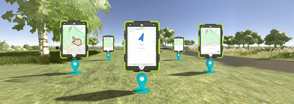
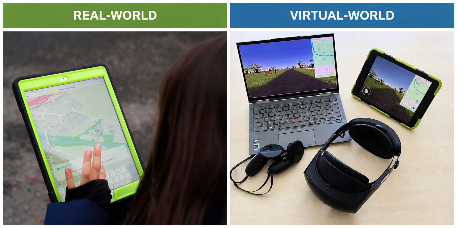
Studies across different environments and platforms
You can run studies across a wide range of environments and platforms: Conduct single-participant or group studies in real-world settings, or deploy experiments in virtual environments on computers and tablets. For a fully immersive experience, studies can also be run using VR headsets.
For each study, you define a starting location and a sequence of tasks. Participants are guided through the experiment by completing each task in the specified order. Throughout the experiment, their movements and viewing directions are continuously recorded and made available to the experimenter for easy data analysis.
Experimental Tasks
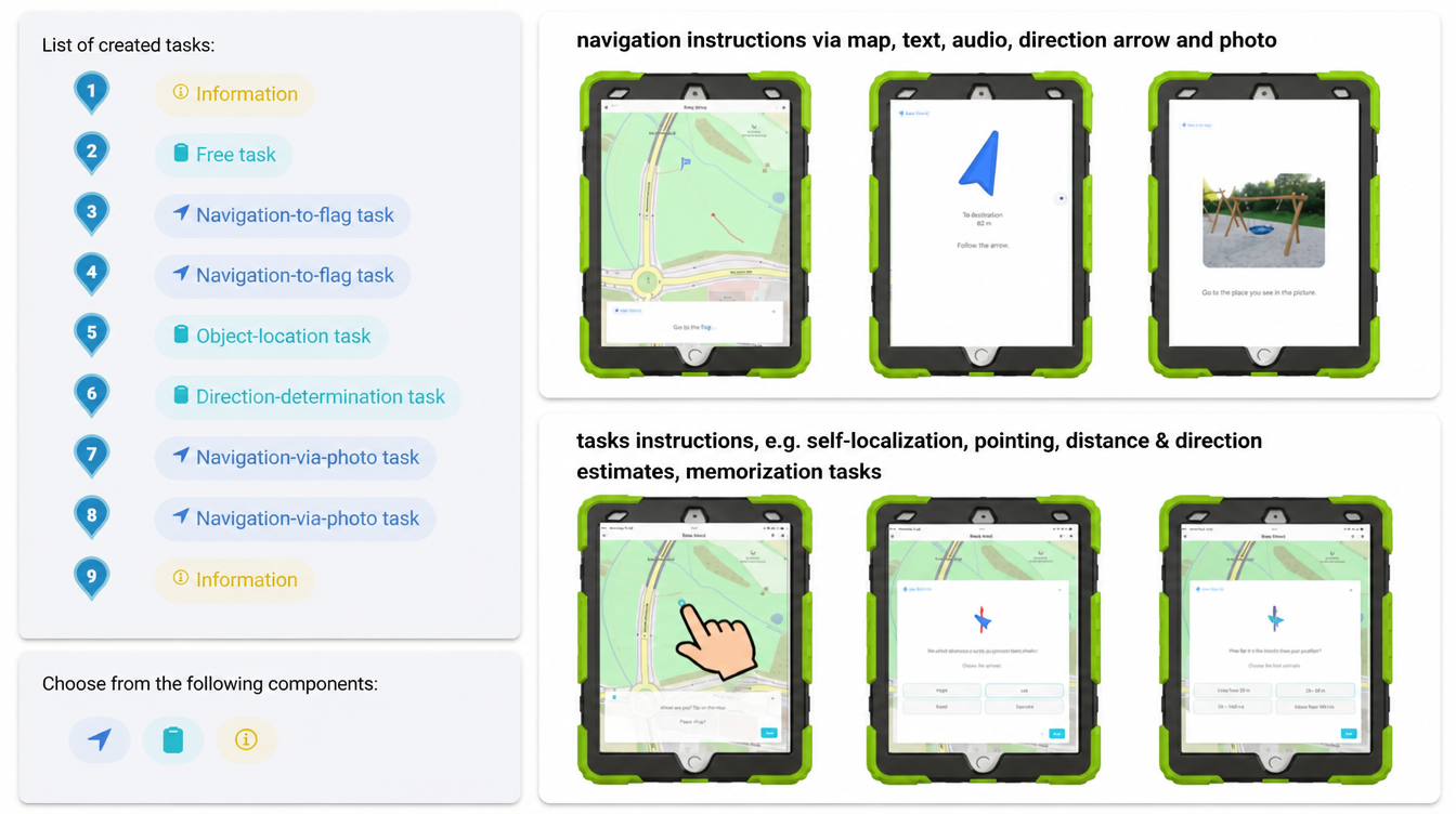
Every study is fully customizable. The experimenter defines which tasks participants complete, in which order, and at which locations within the environment.
A wide range of navigation instructions can be used, including map-based guidance, text or audio instructions, landmark references, and directional arrows. At different locations, additional tasks can be integrated, such as self- or object-localization, pointing tasks, distance and direction estimates, multiple-choice questions, and many other response formats.
Environments
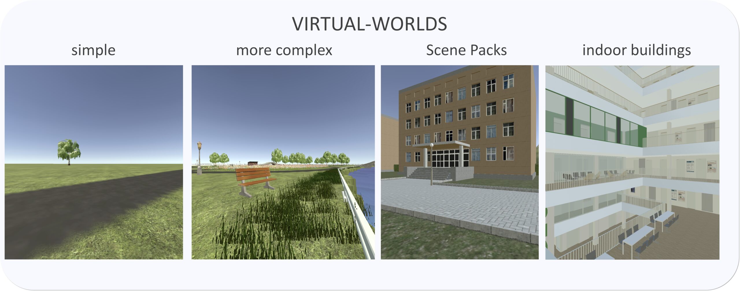
With GPS and OpenStreetMap integration, GeoGami can be used anywhere in the world. In virtual environments, settings can be designed quickly and easily—from simple, controlled environments to complex, multi-layered buildings.
All VR worlds are Unity-based. In addition to custom-built environments, ready-to-use out-of-the-box worlds can also be integrated.
The App
Download the app from the app store or explore it on the web.